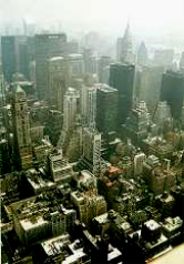
The geographical position of the USA. Resources. Main cities
Lesson
The geographical position of the USA. Resources.
Main cities
Мета: активізувати лексику по темі; практикувати учнів в умінні ставити логічні запитання; розвивати вміння вдум-ливо читати текст, виділяти головне; вдосконалювати на-вички роботи в групах; розвивати навички самостійної та творчої роботи; сприяти розвитку пам’яті, уяви, уваги, мис-лення, мовлення; виховувати здатність толерантно ставити-ся до думки співрозмовника.
PROCEDURE
1. Warm up
Answer the questions
- Where is the USA situated?
- What is the climate of the USA like in general?
- What are the seasons in the USA like?
- What the biggest cities in the USA do you know?
2. Reading.
Students work in 4 groups. They read the texts in their groups, then exchange their representatives, and these representatives retell the texts they’ve read.
Group 1.
Before you read
Use the dictionary to know the meaning of the new words.
The USA Basic Facts
Location:
North America, bordering both the North Atlantic Ocean and the North Pacific Ocean, between Canada and Mexico
Map references: North America
Area:
total area: 9,372,610 sq km
land area: 9,166,600 sq km
comparative area: about half the size of Russia; about three-tenths the size of Africa; about one-half the size of South America (or slightly larger than Brazil); slightly smaller than China; about two and one-half times the size of Western Europe
note: includes only the 50 states and District of Columbia
Land boundaries: total 12,248 km, Canada 8,893 km (including 2,477 km with Alaska), Cuba 29 km (US Naval Base at Guantanamo Bay), Mexico 3,326 km
Coastline: 19,924 km
Climate: mostly temperate, but tropical in Hawaii and Florida and arctic in Alaska, semiarid in the great plains west of the Mississippi River and arid in the Great Basin of the southwest; low winter temperatures in the northwest are ameliorated occasionally in January and February by warm winds from the eastern slopes of the Rocky Mountains
Terrain: vast central plain, mountains in west, hills and low mountains in east; rugged mountains and broad river valleys in Alaska; rugged, volcanic topography in Hawaii
Natural resources: coal, copper, lead, molybdenum, phosphates, uranium, bauxite, gold, iron, mercury, nickel, potash, silver, tungsten, zinc, petroleum, natural gas, timber
Land use: arable land: 20%, permanent crops: 0%, meadows and pastures: 26%, forest and woodland: 29%, other: 25%, irrigated land: 181,020 sq km (1989 est.)
Environment:
current issues: air pollution resulting in acid rain in both the US and Canada; the US is the largest single emitter of carbon dioxide from the burning of fossil fuels; water pollution from runoff of pesticides and fertilizers; very limited natural fresh water resources in much of the western part of the country require careful management; desertification.
Natural hazards: tsunamis, volcanoes, and earthquake activity around Pacific Basin; hurricanes along the Atlantic coast; tornadoes in the midwest; mudslides in California; forest fires in the west; flooding; permafrost in northern Alaska is a major impediment to development.
Note: world's fourth-largest country (after Russia, Canada, and China)
Traditionally the USA is divided into several regions:
- New England, made up of Maine, New Hampshire, Vermont, Massachusetts, Connecticut, and Rhode Island.
- The Middle Atlantic, comprising New York, New Jersey, Pennsylvania, Delaware, and Maryland.
- The South, which runs from Virginia south to Florida and west as far as central Texas. This region also includes West Virginia, Kentucky, Tennessee, North Carolina, South Carolina, Georgia, Alabama, Mississippi, Arkansas, Louisiana, and parts of Missouri and Oklahoma.
- The Midwest, a broad collection of states sweeping westward from Ohio to Nebraska and including Michigan, Indiana, Wisconsin, Illinois, Minnesota, Iowa, parts of Missouri, North Dakota, South Dakota, Kansas, and eastern Colorado.
- The Southwest, made up of western Texas, portions of Oklahoma, New Mexico, Arizona, Nevada, and the southern interior part of California.
- The West, comprising Colorado, Wyoming, Montana, Utah, California, Nevada, Idaho, Oregon, Washington, Alaska, and Hawaii.
![]()
Group![]()
![]() 2
2![]()
Before you read
Use the dictionary to know the meaning of the new words.
Geography and regional characteristics.
The USA stretches from the heavily industrialized, metropolitan Atlantic coast, across the rich farms of the Great Plains, over the Appalachian and the Rocky Mountains to the densely populated West coast. Alaska and the island state of Hawaii are detached from the main mid-continental group of 48 states. America is the land of physical contrasts, including the weather. Most of the USA is the temperate zone with four distinct seasons, while the northern states and Alaska have extremely cold winters, and the southern parts of Florida, Texas, California have warm weather year round.
The area of the United States is 9 629 091 square km.
The United States is the land of bountiful rivers and lakes. Minnesota is the land of 10.000 lakes. The Mississippi River runs nearly 6 thousand km from Canada to the Gulf of Mexico. The St. Lawrence Seaway connects the Great lakes with the Atlantic Ocean.
Underground, a wealth of minerals provides a solid base for American industry. History has glamorized the gold rushes of California and Alaska and the silver finds in Nevada.
Group 3
Geographical Position. Climate. Rich Resources
The United States of America stretches from Atlantic Ocean across North America and far into the Pacific.
Because of such a huge size of the country the climate differs from one part of the country to another. The coldest climate is in the northern part, where there is heavy snow in winter and the temperature may go down to 40 degrees below zero. The south has a subtropical climate, with temperature as high as 49 degrees in summer.
The continental part of the USA consists of the highland regions and two lowland regions. The highland regions are the Appalachian mountains in the east and the Cordillera in the west. Between the Cordillera and the Appalachian mountains are the centre! Lowlands which are called- the prairie, and eastern low-lands called the Mississippi valley. There are many mountains especially in the west and southwest. The Rocky mountains extend all the way from New Mexico to Alaska.
Many rivers cross the country. The most important are the Mississippi, Missouri, Colorado, Sacramento. The main lakes in the USA are the Great Lakes in the north. The nation's natural advantages and resources are probably greater than those of any other area of equal size. The land is as varied as it huge. There are plains and mountains, grasslands and forests, sandy soil, clay and rich, dark loams.
The mineral resources vary from precious gold and rare uranium to common lead and zinc. Coal, oil, iron, copper and other minerals are abundant. They form basis of modern industry.
Questions:
1. Does climate differ from one part of the country to another?
2. How many parts does continental part consist of?
3. Are there many mountains in the USA?
4. What are the most important rivers?
5. Is the USA rich in natural resources?
6. What forms basis of modern industry?
Vocabulary:
to stretch — простягатися
to consist — складатися
to extend — простягатися, тягтися
advantage — перевага
equal — рівний
clay — глина
precious — дорогоцінний
Group 4
Before you read
Use the dictionary to know the meaning of the new words.
Cities of the USA
 Amounts large and famous American cities are Chicago, Boston, Philadelphia, Los Angeles, San Francisco and New York. Washington is the capital of the USA. It is situated on the Potomac River in the District of Columbia.
D. Washington chose the place. The city was founded in 1791 and named after the first president. Now Washington is the residents of the president and the congress. The center of the city is on Capital Hill. This building houses both the Senate and a House of Representatives. The White House is one of the oldest buildings in the city. It is the president’s residents. Washington is a large scientific and cultural center. There are five universities in the city. The national academy of sciences and the library of congress are in Washington too. The national museum, the old and new national galleries of art, Washington, Jefferson and Lincoln memorials are among the city sites.
New York is the largest city in USA. It is an economic, financial, scientific and cultural center. Dutch settlers founded the city in 17 century. The heart of the New York is Manhattan. It was hear that the Dutch built the first building of the town. The name Wall Street remained from our days. The business center of New York is near Wall Street. Another famous street is Broadway. It is the longest and the widest street in New York. It is the street there most famous theaters are situated. New York is the city of famous skyscrapers. The highest buildings are Impure State Building and the united national building.
3. After-reading activities.
1. Agree or disagree with the statements. Give your reasons.
1) The area of the United States is 8 629 091 square km.
2) Minnesota is the land of 1.000 lakes.
3) The Mississippi River runs nearly 6 thousand km from Canada to the Gulf of Mexico.
4) The United States of America stretches from Atlantic Ocean across North America and far into the Pacific.
5) The south has a subtropical climate, with temperature as high as 30 degrees in summer.
6) The mineral resources don’t vary from precious gold and rare uranium to common lead and zinc.
7) The city was founded in 1691 and named after the first president.
8) New York is not the largest city in USA.
9) The business center of New York is near Wall Street.
10) Dutch settlers founded the city in 15 century.
2. Translate the sentences into Ukrainian.
1) Amounts large and famous American cities are Chicago, Boston, Philadelphia, Los Angeles, San Francisco and New York.
2) The nation's natural advantages and resources are probably greater than those of any other area of equal size.
3) Underground, a wealth of minerals provides a solid base for American industry.
4) The continental part of the USA consists of the highland regions and two lowland regions.
5) Most of the USA is the temperate zone with four distinct seasons, while the northern states and Alaska have extremely cold winters, and the southern parts of Florida, Texas, California have warm weather year round.
4. Relaxation.
Comment on the jokes.
Doctor’s Orders
Servant: Sir, wake up, wake up!
Master: What is the matter?
Servant: It’s time to take your sleeping tablets.
Politeness
Mother: Which apple do you want, Tom?
Tom: The biggest one.
Mother: Why, Tom, you should be polite and take the little one.
Tom: Well, Mamma, should I lie just to be polite?
His Pipe
Little girl: Grandpa, would you like me to give you a new pipe for your birthday?
Grandpa: That’s very nice of you, Mary, but I have got a pipe.
Little girl: Don’t think you have, grandpa, I’ve just broken it.
A Good Student
Professor: Can you tell me anything about the great chemists of the 17th century?
Student: Yes, sir, they are all dead. Sir.
5. Homework.
A. Project work. The students are divided into groups according to the number of cities. Their task is to pretend each group is a tour agency and create a leaflet advertising their city for tourists to be attracted. The projects then should be posted in the classroom.
B. Choose some of the “The USA Basic Facts” and write about them.


про публікацію авторської розробки
Додати розробку
