"The United Kingdom of Great Britain and Northern Ireland". Конспекти уроків.
Lesson 1
Theme: The Sea Trip To Great Britain
Objectives:
-to learn new vocabulary concerning the topic;
-to develop student’s ability to read effectively;
-to develop speaking skills;
-to enrich student’s knowledge on the topic;
Supplies: sheets of paper with a new vocabulary , cards, maps, hand out ”Match the Pairs”, Hidden Words”, “Odd One Out”, “Key-facts”
Type of the lesson: presentation of a new vocabulary
Procedure
I. The beginning of the lesson
1. Greeting.
Good afternoon! How are you getting on?
Aim
The topic of our today’s lesson is “ The Geografical position of the United Kingdom of Great Britain and Northern Ireland”.
By the end of the lesson you should be able to recognize and understand new words and word combinations in the text, to read and understand the gist and details despite the natural difficulties.
Warming up
Geography quiz.
Would you like to check your knowledge of geography and answer the quiz.
Use the World map if you want.
Geography Quiz
- Which island is the largest in the world?
- Which river is the longest in the world?
- Which ocean is the biggest?
- What lake is the deepest in the world?
- What is the resemblance between Kyiv, Ottawa and London?
- Black, Red, White, Yellow — what word (not “colour”) can be added to each of these to put them all in the same group?
- Is the UK an European country?
(Yes, it is. It lies in the northwest of Europe).
|
a climate a compass a continent an island a strait a zero mild to occupy to separate to surround to be situated to be washed
|
Острів Протока М’який Займати Омивати Оточувати Клімат Компас Займати Відокремлювати Континент Нуль
|
c). Some words are hidden among the letters. Find them and then read them aloud.
Dfehclimateuokh islandkitcfewstraitjhrdmildvtokgoccupybgemseparatenhu
Mtyedcompasssurroundvtrektobesituatedcontinentjjkodexctobewashed
d). Odd one out
Warm, mild, hot, cosy
To be proud, to be washed, to be situated, to be separated
A river, a lake, a pool, a strait
e). Match the following words with their meanings.
climate continent island
strait
border
territory population inhabitant
area
-the official line that separates two countries;
-one of the people who live in a particular place;
- a large mass of land surrounded by sea;
- the typical weather conditions in a particular area;
-a narrow passage of water between two areas of
land, usually connecting two seas ;
-a particular part of a country, town etc;
-the number of people living in a particular area,
country;
- a piece of land completely surrounded by water;
- the land of a particular type or the land that is
owned or controlled by a particular state;
2. Reading
Pre-reading activities.
a) Read and pronounce the geographical names correctly:
Ben Nevis— a name of the mountain in Scotland
Loch Lomond— a name of the lake in Scotland
the Gulf Stream— a warm current which flows from
the Gulf of Mexico towards Europe
Wales — one of the countries of Great Britain
Northern Ireland — one of the countries of Great Britain
Thames — a river London stands on
b) Exercise 4 page 109
Read the article
THE UNITED KINGDOM OF GREAT BRITAIN AND NORTHERN IRELAND
Geography and Climate
The United Kingdom of Great Britain and Northern Ireland is situated on islands. Northern Ireland occupies the northern part of Ireland. It is situated of the separate island. Great Britain consists of three parts. Their names are England, Scotland and Wales. Scotland is situated in the north of Great Britain Wales — in the southwest, and England — in the southeast.
Great Britain is surrounded by seas on all sides and is separated from the continent by the North Sea and the English Channel. The rivers in Great Britain are not long, but many of them are deep. The capital of Great Britain, London, is situated on the Thames River. There are many mountains in the north of England and in Scotland, but they are not very high. The highest mountain in Great Britain is Ben Nevis. There are many lakes in Scotland. The most beautiful is Loch Lomond. There are many countries which are connected with Great Britain by sea.
Thanks to the Gulf Stream the climate of Great Britain is mild. The weather is often foggy and rainy. Summer is not very hot and winter is not very cold. Winter temperature seldom falls below zero.
While – reading activities.
a) Write down the Key-facts about the UK
The United Kingdom of Great Britain and Northern Ireland
Key-facts
- Official name:
- Countries making up Great Britain:
- 4 parts making up the UK:
- Highest mountain:
- Longest river:
- Capital:
- Climate:
Post-reading activities.
a). Listen to the following geographical names from teacher's voice. Read them together with the translation. Find them on the map.
Northern Ireland
England, Scotland, Wales, the North Sea, the English Channel, London, the Thames River, Ben Nevis, Loch Lomond, the Gulf Stream
b). Put down on the map all geographical names mentioned in the text. Indicate the names of the islands and parts of the country, oceans and seas, mountains and rivers.

c). Look at the map of the UK and answer the question.
I. What is an island?
2. Is United Kingdom situated on an island on a continent?
- What territory does Northern Ireland occupy?
- How many parts does Great Britain consist of?
- What are their names?
- Where are they situated?
- What is Great Britain surrounded by?
- What can you say about the rivers in Great Britain?
- Where are the mountains situated?
10.What do you know about London?
11.What do we say about a climate of a country where winters are not very cold and summers are not very hot?
Why do we say that Great Britain has a very good geographical position?
- Which countries are connected with Great Britain by sea?
- What makes the climate of Great Britain mild?
- What can you say about the climate of Great Britain?
III. Finishing the lesson
Summarizing. What topic did we discuss at the lesson? What task was difficult/ boring?
What task did you like most?
Homework. WB. Ex. 1 p. 34
Marks.
I hope that our today's lesson was both useful and interesting for you.
Lesson 2
Theme: Present Perfect Passive
Objectives:
-to practice to use of Present Perfect Passive;
-to develop grammar skills;
-to teach pupils to love English
Supplies: sheets of paper with the tasks, cards, hand out “Jigsaw sentences”
Type of the lesson: grammar lesson
Procedure
I. The beginning of the lesson
1. Greeting.
T: Good morning! How are you getting on?
Ps: We are very well!
Aim
Today we’ll get to know new grammar material Present Perfect Passive.
Warming up
Game “ Jigsaw sentences”
Give a set of jigsaw sentences to each pair or group of four pupils. Ask pupils to make up 3 sentences, read and translate them after that. Which group will be the first one to make up the sentences.
Jigsaw sentences: ( the card are mixed)
|
The United Kingdom of Great Britain |
|
on islands |
|
is situated |
|
and Northern Ireland |
|
|
|
There are |
|
many countries |
|
by sea |
|
Great Britain |
|
which are connected with |
|
|
|
Thanks |
|
is mild |
|
Great Britain |
|
the climate of |
|
is mild to the Gulf Stream |
II. The main part of the lesson
1. Presenting and practicing Grammar
THE PASSIVE VOICE
The Active sentences focus on what the person (subject) does, did, or will do.
The passive sentences focus on the object of the action:
My Granny bought vitamins for me. (Active Voice.)
Vitamins were bought for me. (Passive Voice.)
We use the Passive Voice if we don't know, don't care or don't want to say
who (or what) did the action. The Passive Voice focuses on processes rather than
on people.
We form the Passive Voice by means of the verb to be and the third form (Past Participle)
of the main verb.
Changing from Active into Passive
• The object of the active sentence becomes the subject in the passive sentence.
The active verb changes into a passive form.
The subject of the active sentences becomes the agent.
The agent is not mentioned when:
-it is unknown;
-it is unimportant;
-it is obvious from the context.
Present Perfect Passive Voice
To be + V3
|
Positive |
Negative |
|
They have been visited |
They have not been visited |
|
It has been built |
It has not been built |
|
Question |
Answer |
|
Have the museums been visited by many friends the other days? Has it been built yet? |
Yes, they have./ No, they haven’t( have not).
Yes, it has. / No, it hasn’t( has not). |
|
Use |
Example |
|
When the person or thing that has done the action isn’t important, or when we don’t know who has done it. |
Coffee has been grown in Brazil. |
Exercise on Passive Voice - Present Perfect
Rewrite the sentences in passive voice
- Kerrie has paid the bill. – The bill has been paid by Kerrie.
- I have eaten a hamburger. -
- We have cycled five miles.
- I have opened the present.
- They have not read the book.
- You have not sent the parcel.
- We have not agreed to this issue.
- They have not caught the thieves.
- Has she phoned him?
- Have they noticed us?
Write passive sentences in Present Perfect.
- the postcard / send – The postcard has been sent.
- the pencils / count
- the door / close
- the beds / make
- the mail / write
- the trees / plant
- the money / spend
- the room / book / not
- the rent / pay / not
- the people / inform / not
Complete the sentences (Active or Passive Voice). Use Present Perfect Simple.
- The car (steal) - The car has been stolen.
- I (bake) _____________ a cake.
- My friends (buy) __________ a house.
- The cup (put) ______________ on the table.
- Trees (plant) ______________ in the street.
- The boy (fall / not) ____________- off his bike.
- I (bite / not) __________ by a snake.
- He (step) _____________ on my toe.
- We (walk) ______________ all the way home.
- She (pick up / not) _______________-- by a friend.
Show the Passive Voice in the text
The Canterville Ghost
Chapter I
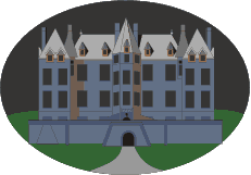
When the American, Mr Otis, bought Canterville Castle, everyone told him that this was very foolish, as the place was haunted. But Mr Otis answered, “I come from a modern country, where we have everything that money can buy. And if there were such a thing as a ghost in Europe, we would have it at home in one of our museums.”
A few weeks later, on a lovely July evening, Mr Otis, his wife and their children, Washington, Virginia and the twins, went down to their new home. When they entered the avenue of Canterville Castle, the sky suddenly became dark and a spooky stillness was in the air.
Mrs Umney, the housekeeper, led them into the library of the castle, where they sat down and began to look around. Suddenly, Mrs Otis saw a red stain on the floor just by the fireplace and said to Mrs Umney, “I am afraid something has been spilt there.”
“Yes, madam,” said the old housekeeper in a low voice, “blood has been spilt on that spot.”
“How terrible,” said Mrs Otis; “I don't want any blood-stains in my sitting-room. It must be removed at once.”
The old woman smiled and answered, “It is the blood of Lady Eleanore de Canterville, who was murdered on that spot by her husband, Sir Simon de Canterville, in 1575. Sir Simon disappeared seven years later. His body has never been found, but his ghost still haunts the Castle. The blood-stain is a tourist attraction now and it cannot be removed.”
“That is all nonsense,” said Washington, the eldest son of the Otis family, “stain remover will clean it up in no time,” and he took a bottle of stain remover out of his pocket and cleaned the spot. But as soon as the blood-stain had disappeared, a terrible flash of lightning lit up the room and a fearful peal of thunder made the whole building shake.
Game ”What's been changed?”
Present perfect passive group speaking activity
Procedure:
Divide the pupils in two (more or less) equal groups: A and B.
Write up on the board and tell the pupils that this activity is called "What's been changed?"
Tell the pupils to memorize the position and state of everything in the room (allow 2 minutes).
Tell the pupils that group A is going to leave the room for 5 minutes, and during that time group B will change things in the room. When the pupils in group A come back, they will have to identify what's been changed.
Scoring:
Each pupil in group A who uses the target structure to identify a change gets 1 point.
If the pupil identifies an actual change, they get an additional 1 point.
Points are not awarded to pupils who don't use the target structure correctly, on the other hand
any other pupil who catches an error and corrects it gets the point. This encourages
attentiveness and greater participation by all the pupils.
The pupil with the most points after the time limit / all changes have been identified wins.
In any case, the dialogue should go something like this:
Pupil A1: "A-ha! The lights have been switched off.
Pupil B: "That's right. They've been switched off." (pupil A1 = 2 points)
Pupil A2: "And you moved the dictionary."
Pupil A1: "No, you're supposed to say the dictionary has been moved.'"
Pupil B: "No, it hasn't been moved." (pupil A2 = 0 pt, pupil A1 = 1 pt)
Use these clues:
switch on / off + the lights / television
move + table / chair / rubbish bin or wastebasket / clothes ...
open / close + the window / cabinet or cupboard / book / box
wipe or erase + the board
write / draw + on the board
unplug / plug in + the television / cassette or DVD player
put away + pens / pencils / notebooks / books...
turn over + notebooks / books
III. Finishing the lesson
Summarizing. What have we done at the lessons? What grammar have we learnt at the lesson today? What difficulties did you have? Have you got any difficulties with the Present Perfect Passive?
Homework. WB. Ex. 1-3 p.34 - 35
Marks.
Lesson 3
Theme: The Geography and Climate of Ukraine
Objectives:
- to activate pupils’ speaking skills through various creative activities,
- to revise vocabulary which concerns the theme, to practise reading,speaking.
- to develop student’s ability to read effectively;
- to develop pupils’ creative imagination, logical thinking, memory.
Supplies: cards, map, hand out” Key-facts”,
Type of the lesson: speaking lesson
Procedure
I. The beginning of the lesson
1. Greeting.
Good afternoon! How are you getting on?
Aim.
The topic of our today’s lesson is “The Geography and Climate of Ukraine ”.
By the end of the lesson you should be able to recognize and understand new words and word combinations in the text, to read and understand the gist and details despite the natural difficulties, to talk about the geographical position and climate of Ukraine.
Warming up.
Do you the main geographical terms?
Let’s check your knowledge.
Say what it is:
The most important town in a country... (capital)
A large town... (city)
A rounded and raised landform, not as high as mountain... (hill)
Low ground between hills... (valley)
A body of land surrounded by water, smaller than a continent... (island)
A big piece of water with land around it... (lake)
A large stream of water that flows across the land... (river)
The body of salt water covering nearly three fourths of the Earth's surface... (ocean)
The weather that a place has... (coast)
II. The main part of the lesson
1. Reading
Pre-reading activities.
a) Problem solving.
T: What do you think?
Look at the map of the country and answer the questions:
Is the geographical position of our country suitable for the development of its relations with foreign countries and its industrial development?
6) Pronunciation drill.
Read and pronounce the geographical names correctly:
Ukraine
the Autonomous Republic of Crimea
Poland
Slovakia
Hungary
Romania
Moldova
Belorus
Russia
Read the text on page 115 exercises 1.
While-reading activities.
Write down the Key-facts about Ukraine
Key-facts
- Official name:
- Area:
- Extension:
- Borders on:
- Population:
- Main river:
- Capital:
- Climate:
Post-reading activities.
a). Complete the sentences.
I.Ukraine covers an area of...
- Its territory stretches for...
- Our country borders on ...
- Ukraine is washed by ...
- The two mountainous areas are ...
- The main rivers are ...
- The climate is ...
- The flora of Ukraine is ...
- The fauna (animal life) is ...
- The population of Ukraine is ...
2. Speaking
a). Role-play the situation in pairs. You are in one of British schools. The British teacher of Geography wants his/her pupils to know more about Ukraine. Answer his/her questions.
- Where is Ukraine situated?
- What can you say about its geographical position?
- Which countries does it border on?
- What seas is Ukraine washed by?
- What part of Ukraine is occupied by the mountains?
- Is Ukraine visited by tourists?
- What are the tops of high mountains usually covered with?
- What nationalities is your country inhabited with?
- Which sea is the southern part of Ukraine washed by?
10. What languages are spoken in Ukraine?
b). Work in pairs and make up a dialogue between a travel agent and a customer, who wants to visit the country and wants to know something about it. Use the facts from the text.
c). Here are some facts about the weather in Ukraine.
Which do you think are the most important for a visitor to know? Why do you think so?
In general the country's climate moderate-continental, subtropical only in the southern part of the Crimea. The differences in climate are caused by many factors: landscape, distance to and oceans... The climate varies not only from the north to the south, but from the northwest to the southwest as the warm air masses are moving from northwestern part of Atlantic Ocean.
The average temperature in Ukraine varies between +5; +7 °C in the and+11;+13°C inthe south.
The coldest month is January with a record low of-42 °C. The warmest month is July with a record high of +40 °C. Rain and snow ranges from about 76 cm a year in the north to about 23 cm in the south. The highest rainfall is in Carpathian and Crimean mountains.
Organize a discussion on the following questions.
What practical advice would you give to a visitor about the weather in Ukraine?
What clothes should they bring in summer? In winter?
III. Finishing the lesson
Summarizing. What have we done at the lessons? Is it geographical position of our country suitable for the development of its relations with foreign countries?
Homework. Ex. 6 -pp. 118-119
Marks.
Lesson 4
Theme: The UK
Objectives:
- to activate pupils’reading skills, trying to get the main information from the text:
- to speak about the UK;
- to use new vocabulary in the sentences:
- to review the previous material;
- to develop pupils’ logical thinking, memory
- to broden pupils’ knowledge about the UK
Supplies: cards, map, hand out” "Rearrange the words", “ True or False.”
Type of the lesson: reading lesson
Procedure
I. The beginning of the lesson
1. Greeting.
- How do you do!
- How do you do!
Aim.
The topic of our today’s lesson is “The UK”.
By the end of the lesson you should be able to apply knowledge of the words and expressions for this topic in a new situation, to talk about the UK.
Warming up.
Game "Rearrange the words"
Write the following words on the blackboard:
inhabitant, climate, cafe, people, exhibition, the British, mountain, hotel, church,
Ukrainians, valley, theatre, avenue, lake, Scottish , forest, .
Explain to pupils that each word belongs to one of the three distinct categories.
Their task is to work out what the three categories are, and to rearrange the words
into three groups.
Ask them to work in pairs.
The first pair to finish is the winner.
For example:
Geographical features: climate, mountain, valley, lake, forest.
II. The main part of the lesson
- Reading
Exercise 1, page 120-121
Pre-reading activities
a). Is United Kingdom situated on an island or on a continent?
What territory does Northern Ireland occupy?
How many parts does Great Britain consist of?
What are their names?
b) Look at the new words on page 120 and repeat after me.
Read the text on page 120 exercises 1.
While-reading activities.
- complete the sentences:
The symbol of England is …
The symbol of Wales is …
Post-reading activities.
- True or False. Correct the false sentence.
The most famous lake is called Nessie.
Edinnburgh is the capital of Wales.
Edinburgh has a huge festival every summer.
A red rose is the symbol of England.
Rugby is a national sports in Wales.
Welsh is studied at school.
b).WB. Ex.1-2, p. 36
Rank the following kinds of geographical relief of the earth surface according to their height over the sea level. Start with the highest.
mountain
plain
mountain
highlands
valley
hills
uplands
lowlands
Match the names of the countries with some notes about them.
1. Northern Ireland
2. England
3. Wales
4. Scotland
a) The popular musical instrument in this country is harp. People are fond of rugby. Road signs are usually in native language and in English.
b) This is the most mountainous area in Great Britain. The country is popular with campers and climbers. A huge festival of music and literature takes place here every year.
c) This is the part of a separate island. Saint Patrick is a patron of it. Bagpipes and fiddles are considered as traditional music instruments in this country.
d) You can find lots of plains and meadows here. Gardening is very popular among the population. People are proud of its language because it is spread out over the whole UK.
Read the sentences and tick E (England), S (Scotland), W (Wales), NI ( Northern Ireland). There is more than one answer possible.
1. In this country people are crazy about gardening.
2. In this country you may see different shades and tones of green.
3. In this country men wear skirts called the kilts.
4. You can see a red dragon on the flag of this country.
5. In this country rugby is the national sport.
6. The symbol of this country is a red rose.
7. The most famous symbol of this country is the shamrock.
8. In this country there are many lakes called the lochs.
9. People who live in these countries don't like it when they called English.
10. These people are especially proud of their language.
Fill in the words from the 'New Vocabulary'.
1. When you speak about the ... of a place you mean its hills, rivers, forests
and so on.
2.... is a large area of land with very few trees on it.
- ... is a field which has grass and flowers growing in it.
- ... is a long and narrow1 piece of land between hills.
- People who live in their own house, usually put a ... around it and a small yard in front of it.
- ... are low-lying lands.
- ... are lands in the mountains.
Speaking.
Ask and answer in pairs.
- What would you like to see in Scotland? Why?
- What was Helen impressed by in England?
- What parts of England did she visit? What did she see there?
- What do the holiday makers like in Wales?
- What can anyone see in Wales?
- What was Maxym surprised with?
III. Finishing the lesson
Summarizing. What have we done at the lessons? What is the most beautiful part of England for you? Why?
Homework. Ex. 4 p.121
Marks.
Lesson 5
Theme: British Cities
Objectives:
- To check the pupils’ skills of listening and understanding the English speech;
- to develop pupils’ memory;
- - to teach pupils to work in pairs, groups:
- To teach pupils to collect information and make the conclusions.
Supplies: cards, map, pictures
Type of the lesson: listening lesson
Procedure
I. The beginning of the lesson
1. Greeting.
- How do you do!
- How do you do!
Aim.
The topic of our today’s lesson is “British Cities”.
By the end of the lesson you should be able to give your own points of view on the topic, to talk about the British cities.
Warming up.
What words do you associate with topic of our lesson? Do you remember the names of main cities features?
Let’s make up “Mind Map” according to our topic.
Large squares Galleries Theatres
![]()

![]()

Old churches
|
|

![]()

Long avenues
Large squares
Ancient cathedrals
Make up as many sentences as you can to describe a modern town or city.
II. The main part of the lesson
- Listening “ Britain and the British”
Pre-listening activities
a) Before listening learn to read and pronounce the names of some British cities. Find them on the map.
Manchester
Liverpool
Bristol
Portsmouth
Birmingham
Stratford-upon-Avon
Leeds
b) Listen to the lecture about the population of Great Britain and try to remember the nationalities of the inhabitants who live in parts of the country.
While-listening activity
Listen to the text and fill in the table.
|
Country |
Capital |
People |
Language |
|
Great Britain |
London |
The British |
English |
|
England |
London |
|
English |
|
Scotland |
Edinburgh |
|
English,Gaelic |
|
Wales |
Cardiff |
|
English, Welsh |
|
Northern Ireland |
Belfast |
|
English, Irish |
Post – Listening Activities.
Listen about the population of Great Britain again and complete the sentences choosing right answers.
- More than _______ million people live in Britain.
a) 65 b) 46 c) 56
2. ... are the biggest industrial cities in the centre of England
a) Manchester and Leeds
b) Liverpool and Manchester
c) Leeds and Birmingham
3) Many sailors and fishermen live in Liverpool, ....
a) Plymouth and Portsmouth
b) Sheffield and Portsmouth
c) Portsmouth and London
4. ... is the birthplace of famous Shakespeare.
- Bristol
- Manchester
- Stratford-upon-Avon
- In some parts of... and Wales people speak other languages besides English.
- a) England b) Scotland c) Britain
- Everyone in the UK speaks English ....
a) clearly
b) in the same way
c) differently
Use the table you have copied and name the capitals of:
-England -Northern Ireland -Scotland -Great Britain -Wales
What country has the same capital as Great Britain on the whole?
-
Work in pairs. Ask and answer about the people, the language and the capitals of each part of Great Britain
Work in pairs
Each group get a card with a task.
The task is to put sentences about one of the British cities in the right logical order.
Card 1.
The University of Manchester founded in1880 is famous for its studies.
With its large suburb Salford Manchester has a population of nearly one million.
Manchester is the centre of the cotton industry.
Manchester has few ancient buildings, but few English cities have better parks of which there are over fifty.The largest of them is Heaton Park. Manchester is rich in libraries and schools.
Card 2.
It is a centre of the iron industry.
The district around Birmingham is known as the Black Country.
It is a land of factories and mines. Steam-engine, motor-cars, railway carriages, bicycles are manufactured in the factories of the Black Country.
In the heart of England about 112 miles north-west of London is Birmingham.
Birmingham is a city with population of over one million.
Card 3.
This was the port from which many ships sailed in Elizabeth's reign.
Bristol is divided into two parts.
Bristol is not a very large port.
The University building has a very high tower from the top of which you can see College Green, many churches and Park Street.
The eighteenth century stone houses climb up the hills past the beautiful and little-known cathedral to the second part of Bristol. It has a wooden eighteenth century theatre untouched since those days.
One of them is the port on the Avon with narrow streets, old churches and houses.
Bristol has a college named College Green, the University, the art gallery and some museums.
This part is more modern and it has many fine houses built of pink stone and many wonderful monuments and churches.
Card 4.
The first place we went to was Shakespeare's birthplace—a small house with small rooms in the centre of Stratford. We saw the very room where Shakespeare was born. Lots of people who had visited the house had written their names on the walls. It seemed a wrong thing to do—although among the names were Walter Scott, Dickens.
Stratford is a very interesting town, right in the centre of England. It is nice to think that Shakespeare was born right in the heart of England and in the midst of the country that is so typically English.
There are no mountains or deep valleys near Stratford; there's nothing of the grand scenery that we have in Scotland, but there are beautiful woods, green fields, a quiet gentle river—the winding Avon—and lovely houses, black and white with thatched roofs.
Solve the crossword.
|
4.s |
|
6.b |
|||||||||||||||||
|
|
|
t |
|
5. E |
|
e |
|||||||||||||
|
r |
d |
l |
|||||||||||||||||
|
3.c |
a |
r |
d |
i |
f |
f |
|||||||||||||
|
|
t |
|
n |
|
a |
||||||||||||||
|
|
f |
b |
s |
||||||||||||||||
|
|
|
|
o |
|
u |
|
t |
||||||||||||
|
2.m |
|
r |
r |
|
|||||||||||||||
|
a |
|
d |
|
|
g |
||||||||||||||
|
1.l |
o |
n |
d |
o |
n |
h |
|||||||||||||
|
i |
|
c |
|
n |
|
|
|||||||||||||
|
v |
h |
a |
|||||||||||||||||
|
e |
e |
v |
|
||||||||||||||||
|
r |
s |
o |
|
||||||||||||||||
|
p |
t |
n |
|
||||||||||||||||
|
o |
e |
|
|||||||||||||||||
|
o |
r |
|
|||||||||||||||||
|
l |
|
||||||||||||||||||
Down
- One of the biggest port.
- one of the biggest industries city
- the birthplace of William Shakespeare
- the capital of Scotland
6. the capital of the Northern Ireland
Across
- the capital of Great Britain
3. the capital of Wales
III. Finishing the lesson
Summary of today’s work at the lesson.
Homework. Ex.3 p.124
Marks.
Lesson 6
Theme: The USA
Objectives:
- To check the pupils’ skills of listening and understanding the English speech;
- to develop pupils’ memory;
- - to teach pupils to work in pairs, groups:
- To teach pupils to collect information and make the conclusions.
Supplies: cards, map, pictures
Type of the lesson: listening lesson
Procedure
I. The beginning of the lesson
1. Greeting.
- How do you do!
- How do you do!
Aim.
The topic of our today’s lesson is “The USA”.
By the end of the lesson you should be able activize the geographical terms learned at the previous lessons to understand the gist and details of the text for listening and to express your attitude to its contents.
Warming up.
Play the game “ Who will make up more sentences?”, using the words and expressions given below:
To be situated, to be washed , to surround, a climate, to occupy,in the north, in the west, in the eastan ocean, a strait, to border on….
II. The main part of the lesson
At the previous lessons we’ve spoken about the UK. But today we’ll speak about the USA.
1. Listening
Pre-listening activities.
a) Problem Solving.
What do you think?
Look at the map of the USA and answer the question;
Is the geographical position of the USA suitable for the development of its relations with foreign countries?
b) Listen to the following geographical names:
The USA
The Atlantic Ocean
The Pacific Ocean
The Artic Ocean
The Appalachian Mountains
The Rocky Mountains
The Mississippi….
Find them on the map of the USA.
c) Listen, then read the article and match its seven paragraphs to the topics from a) to g) noted after the text.
THE UNITED STATES OF AMERICA
(1) The United States of America is a name of the country composed of 50 states joined in a federal republic, and its citizens are known as "Americans'.
In the north the US is bordered by Canada, and in the south it borders on Mexico. It is washed by the Atlantic Ocean in the East and by the Pacific Ocean in the West.
(2) Hawaii, which became the 50th state in 1959, is situated in the Pacific Ocean halfway between the west-coast states and the Far East.
Alaska is separated from Russia by only about 50 miles across the Bering Strait.
(3) The main part of the United States consists of several physical divisions, including highland and lowland regions. Major highlands are the Appalachian Mountains in the east and the Rocky Mountains in the west. The Rocky Mountains extend from Mexico to Canada. The mountains are crossed by streams which flow through deep canyons and fall into the Pacific Ocean. The largest among them are the Colorado and the Columbia rivers.
These rivers are unsuitable for navigation, but they serve as an immense source of electric power.
- The central lowland between the two main mountain ranges makes up the basin of the Mississippi River. Its main tributaries are the Missouri and the Ohio Rivers. The Mississippi together with the Missouri form the longest river in the world (7,300 km).
The northern part of the USA embraces the region of the five Great Lakes (Lake
Superior, Lake Huron, Lake Michigan, Lake Erie and Lake Ontario), which are connected by natural channels cut by rapids. The greatest of these rapids is the Niagara Falls.
4. Crossed by mountain ranges from north to south, the country unprotected from cold winds from the north and from warm wind from the south. This causes great temperature fluctuations. On the whole, USA has a continental climate.
5. The country is rich in coal, oil, iron and minerals,which form a solid base for the development of American industry. The US economy is highly developed. In fact, the United States is leading countries in the world economy.
6.The people of the United States are a mixture of many different nationalities. The United States is often called a big melting pot of countries. In a melting pot, different metals are melted together make a new metal. The United States is like a melting pot for people. In the past , people from many different European countries came to the US and made one country out of many. In one city you can find people whose parents or great-grandparents came from China, Africa, Southeast Asia and many European countries. These different people brought a wonderful mixture of customs and traditions to their new land. The German brought Christmas trees, the Irish - St. Patrick's Day celebrations, the Scots — Halloween.
7. The red-white-and-blue flag of the United States is known as 'Old Glory' or the 'Stars and Stripes'. Red stands for courage, white for purity and blue for justice.13 stripes represent the first original American colonies, which were united into one country. The stars in the flag, white on the deep blue background, represent the number of states making up the United States. Today it has 50 each state, and 13 stripes, one for each of the original states.
Everyone can be greatly surprised by the fact how Americans
honour and treat their flag. In American schools the day begins with the ceremony of raising the flag.
While –Listening Activity
Write down the Key-facts about the USA
The United States of America
Key- facts
Name:_______________________________________
Area:________________________________________
Washed:_____________________________________
Population:___________________________________
Capital:______________________________________
Climate:______________________________________
Post-Listening Activities
a) Listen, then read the article and match its seven paragraphs to the topics from a) to g) noted after the text.
- the landscape
- the flag
- the geographical
- the mineral resources
- the smallest and the biggest states
- the climate
- the people
b) Say if the statements are true or false.
1. Hawaii is the smallest state of the USA.
2. The Colorado and the Columbia rivers flow through the Rocky Mountains.
3. The Missouri and the Ohio rivers are the tributaries of the Columbia river.
4. There are five lakes in the northern part of the USA, which embrace the area known as the Region of Great Lakes.
5. The people of the USA are known as Germans, Irish and Scots.
6. “Stars and Stripes” is another name of American money.
7.There were 12 original states which gave birth to the USA.
8. The USA is composed of 50 states today.
c) Arrange the words in pairs of antonyms. Write them down into your notebook.
|
South Lowlands Long cold Immense West Old To separate Suitable To take a source Developed Mild climate |
To flow into East North Continental climate Highlands Warm Unsuitable New Undeveloped To join Short Small
|
d) Arrange the words in pairs of synonyms.
|
Immense Region Prominent To compose To separate To flow into A range Unsuitable Highlands Main
|
To make up To divede To fall into A chain Uncomfortable Hills Outstanding Chief Huge area |
- Do the exercise 2 on page 38 in your workbook.
Fill in the following chart ranking the countries in the columns.
Number them 1,2,3 beginning with the biggest. The first is done for you.
|
Country |
Ukraine |
The UK |
The USA |
|
Size |
2 |
3 |
1 |
|
Pouplation |
|
|
|
|
Density of population |
|
|
|
|
Border length |
|
|
|
|
Mountains |
|
|
|
|
Height |
|
|
|
|
Length of rivers |
|
|
|
III. Finishing the lesson
Summary of today’s work at the lesson.
Homework. Ex.8 p.130
Marks.
Lesson 7
Theme: English-Speaking Countries
Objectives:
- to provide opportunities for developing speaking skills based on the topic;
- to develop pupils’ memory;
- to teach pupils to collect information and make the conclusions;
- to teach pupils to respect our native country and the countries the language we are learning;
Supplies: cards, map, pictures
Type of the lesson: speaking lesson
Procedure
I. The beginning of the lesson
1. Greeting.
- How do you do!
- How do you do!
Aim.
The topic of our today’s lesson is “English-Speaking Countries”. By the end of the lesson we’ll be able to speak about English-Speaking countries.
Warming up.
Match the names of the English-speaking with their flags.
The UK
The USA
Canada
Australia
New Zealand
II. The main part of the lesson
- Look at the map of the world and say what countries The UK ( the USA, Canada,Australia, New Zealand) borders on.
Work in group. Each group get the map of one of the English –speaking countries.
Look at the maps and find out the facts and fill in the table. After that it is necessary to represent the country.
|
The full name of the country |
|
|
The total area |
|
|
Population |
|
|
Capital city |
|
|
Large cities |
|
|
Mountains |
|
|
The highest peak |
|
|
Rivers |
|
Use the map of the world and read the paragraphs below. Try to guess what English-speaking country each of the following paragraphs tells about.
1. It is not a large country. It is situated in Europe. It is much smaller than France or Norway. It consists of four ports, but English is the national language in all the parts of this country.
2. This country lies in the middle of the North American continent. Its area is over 9 million square kilometres. The country consists of 50 states. Its national emblem is the bald eagle. The flag is called 'The Stars and Stripes'.
3. This country is a very large country. Its territory is about 10 million square kilometres, people speak English and French there.
4. This country is called the 'upside down country'. The hottest summer month is January and the coldest winter month is June, it lies in the southern hemisphere.
5. This country is situated in the southern hemisphere. When it is midnig in Great Britain, it is midday of the next day in this country. Many peo came to live here at the end of the 16th century.
You are going to read a magazine article about people in Britain. Six sentences have been removed. Choose which sentences (A-G) fit into the gaps (1-6). There is one extra sentence you do not need to use.
A. A red dragon is probably the oldest symbol of Wales.
B. They like to speak Welsh, to sing songs in Welsh and when you travel you can see road signs in Welsh all over Wales.
C.Green is one of the symbols of Ireland and everybody wears green on St. Patrick's Day, the Irish national holiday.
D.The English are also famous for their love of animals.
E. People from Scotland, Wales or Northern Ireland are not English.
F. Traditional tartan skirts are called kilts and many Scotts them - women and men!
G. Every country in the UK has got its own symbol.
People in Britain
The symbol of England is a red rose, and English people are crazy about gardening.
1.____________________________________________________________
A lot of families have pets. English football is famous, of course, but there is another national sport too, cricket. English people like to talk about the weather.
2.____________________________________________________________
Scotland is very famous for its beautiful scenery and the lakes called Lochs. An important symbol of Scotland is a special kind of material called tartan.
Another Scottish symbol is the thistle. People in Scotland play very unusual musical instruments called bagpipes.
3.____________________________________________________
Another symbol of Wales is a vegetable called the leek. People wear them on their coats on St. David's Day, the Welsh national holiday, although some people wear another symbol of Wales - the daffodil. Welsh people are famous for their singing and their musical festivals. Rugby is their national sport.
The most famous symbol of Ireland is the shamrock. In Ireland you may see different shades and tones of green.
4._____________________________________________________________________
The Irish are famous for their playing, singing and dancing. People in Britain are reserved and conservative. They have kept their traditions alive for centuries.
Everyone who was born in Britain is British. People from England are the English.
5. _________________________________________________________
They are the Scottish or the Scotts; the Welsh and the Irish. People from Scotland and Wales don't like it when they are called the English.
Everyone in Britain speaks English. But in some parts of Scotland and Wales people speak different languages as well. The Welsh are especially proud of their language.
6.________________________________________________________
Everyone in the UK speaks English but they all speak it differently.
III. Finishing the lesson
Summary of today’s work at the lesson.
Homework.
Project Work.
Teacher of English: And now you’ve got the last task. I’ll divide you into three groups. Imagine a situation I am a tourist. I want to visit any English-speaking country. The groups will persuade me to visit one of the best English-speaking countries.
Lesson 8
Theme: Knowledge is power
Objectives:
- to generalize and broaden pupils’ knowledge about English-speaking countries;
- to develop pupils’ speaking skills in monologue dialogue speech;
- to develop pupils’ outlook;
- to teach pupils to collect information and make the conclusions;
Supplies: cards, maps, pictures
Type of the lesson: speaking lesson
Procedure
I. The beginning of the lesson
1. Greeting.
2. Aim.
The aim of today’s lesson is to sum up the results of working on the topic. We have to listen to participants of the project.
- Warming up.
- And now look at the blackboard. Here you can see proverbs. Your task will be match the English proverbs with their Ukrainian equivalents.
Knowledge is a treasure, but practice is the key to it. (Arabian)
To know what’s what.
To know everything is to know nothing.
Knowledge is better than money in the bank. (English)
Knowledge is light, ignorance a cloud.
No living man all things can.
Live and learn.
Знати, що і як.
Вчення-світ, невчення-тьма.
Вік живи-вік учись.
Знання- це скарб, навчання-ключ до нього.
Знати все значить нічого не знати.
Жодна людина не вміє усього.
And now read one by one.
Thank you and now match the proverbs. Who knows? Rise your hand. Go to the black board.
Read some statements which will help you to discuss how important knowledge is and answer the questions below.
What do people do if they do not know something important needed for their work or profession? As a rule, they try to get more knowledge about it. They try to learn and understand what they do not know and try to use it in practical life. We need knowledge to be more useful for our society.
There is one English proverb that describes the main idea for today discussio, 'Knowledge is power'. This proverb means that the more a man knows, the greater power he has. Knowledge has given man his great power.
You may think that one cannot know everything. It is correct, of course, but everybody must always try to increase his or her knowledge. You get knowledge at school, from books, magazines, radio and TV programmes, the Internet…
Knowledge of history helps us to understand the past, the present and the future. If your knowledge of other school subjects is good, it will help you in your future life.
1. What does the proverb 'Knowledge is power' mean?
2. Where do you get knowledge?
3. When do people try to get more knowledge?
4. Why do we need knowledge?
II. The main part of the lesson
Last lesson I suggested you to participate in the project. Your task was to imagine a situation I was a tourist. I wanted to visit any English-speaking country. The groups would persuade me to visit one of the best English-speaking countries.”
Introducing the project
The first project group
England

"England" is sometimes, wrongly, used in reference to the whole United Kingdom, the entire island of Great Britain (or simply Britain), or indeed the British Isles. This is not only incorrect but can cause offence to people from other parts of the UK. (Nationality of the British people).
England is part of the United Kingdom, along with Scotland and Wales.
Great Britain, the United Kingdom and the British Isles do not mean the same thing. Great Britain is very often, but incorrectly, used as a synonym for the sovereign state properly known as the United Kingdom of Great Britain and Northern Ireland.
The United Kingdom is made up of
1. England: The Capital is London.
2. Scotland: The Capital is Edinburgh.
3. Wales: The Capital is Cardiff.
4. Northern Ireland: The Capital is Belfast.
Some more facts of England:
Population: 58 million people.
Geographic size: 130,422 square kilometers or 50,356 square miles.
Capital: London.
Major cities and population: London, Liverpool, Birmingham, Manchester and Nottingham.
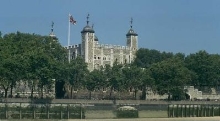
England has a rich history going back hundreds of years. England still maintains a monarchy, with the Queen of England.
You can still see traditional England in much of London, and other cities.
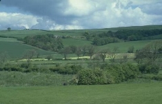
Much of England is rolling hills with occasional small fields or flatland.
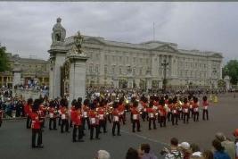
England has many areas of historical interest. The Queen and the Royal Family are a well known international symbol of England. The Buckingham Palace and the changing of the guards are two popular tourist attractions.
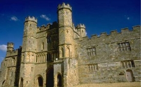
Other attractions include the London Bridge, Big Ben and the Saint Paul Cathedral.
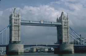
The Tower Bridge is another popular landmark.
England's traditional industries include iron and steel production, coal mining and textiles. Other industries include automobile manufacturing, electronic products and chemicals. The lowlands support some farming such as wheat, potatoes and vegetables. Dairy and sheep farming are common in the hilly pastures.
Britain was one of the first major world powers. British explorers discovered and colonized many parts of the world, including parts of North America. Britain was also one of the first industrial centers.
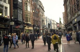
About 85% of the people in England live in cities or towns.
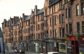
The "brownstone" is a very common form of housing in England.
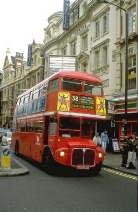
Double Decker buses are common site in London. Many North Americans have trouble driving in England because the steering wheel is on the right hand side of the car, and you drive on the left hand side of the road.
England has a moderate climate with temperatures typically ranging from about freezing to 75 degrees Fahrenheit. England also gets considerable rain.
Welcome to England !
The second project group
Canada
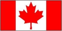
Canada is the second largest country in the world, smaller only to Russia.
Population: 28 million people
Geographic size: 3.9 million square miles
Capital: Ottawa
Major cities and population: Toronto, Montreal, Vancouver, Calgary, Edmonton, Winnipeg, Halifax
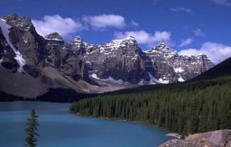
Canada has a very large and diverse range of geographic features. Canada is divided into 10 provinces and 2 territories. Canada stretches from the Pacific Ocean on the west, to the Atlantic Ocean on the east. Northern Canada reaches into the Arctic Circle, while southern Canada stretches below the northern points of the United States.
Canada has a very small population, 28 million people, for its geographic size. Much of Canada is still wilderness, cover by forests. The Rocky Mountains cover a major part of western Canada -- British Columbia, the Yukon Territory, and the western part of Alberta.
West-central Canada is mostly prairie, consisting of large grain farms.
The east-central part of Canada are the provinces of Ontario and Quebec. These are major population and industrial areas.
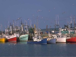
The Maritime provinces on the east coast rely very heavily on the Atlantic Ocean for their way of life.
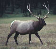
The majority of Canada is still wilderness. This makes Canada a popular spot for hunting and fishing.
Niagara Falls is one of Canada's best known tourist attractions. It is the largest falls in the world, measured in volume of water.
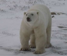
Most of Canada's northern islands are located inside the Arctic Circle.
The industry varies as you look across Canada. British Columbia, on the west coast, has historically relied on natural resources such as mining and timber. Manufacturing is now becoming much more important to the economy. Alberta has benefited from considerable natural resources including oil and natural gas. It is also rich in minerals such as zinc, silver, nickel and uranium. The prairie provinces of Manitoba, Saskatchewan and parts of Alberta produce more than 20% of the world's wheat. Other forms of farming and cattle also contribute to the economy.
Ontario and Quebec are the industrial center of Canada. They have a wide variety of manufactured goods. The lower part of Ontario also has very rich farm land, with many orchards. This Niagara area is also known for its wine production.
The maritime provinces of New Brunswick, Nova Scotia, Prince Edward Island and Newfoundland rely heavily on fishing and natural resources such as timber. Prince Edward Island is also well now for its potatoes.
Native Americans lived in Canada for thousands of years. In the early 1600s, colonists from Britain and France began to settle in eastern Canada, along the St. Lawrence River. Canada proved to be an excellent spot for trapping and trading of furs. In the 1800s, settlers began to push west. Most of the native Americans were displaced by the Europeans.
Both English and French still play a significant role in Canada, with both being official languages. Most of Quebec and parts of eastern Canada are still heavily influenced by their French origins. Much of the rest of Canada is English origin. Canada has also had significant immigration from other European countries such as Germany, Italy and the Ukraine. There are also many immigrants from Asia. The Canadian Government tries very hard to maintain a multi-cultural environment, encouraging people to maintain their heritage.
Most of Canada's population lives within 100 miles of the border with the United States. About 75% of the population lives in major cities or towns. With Canada being so large, the climate varies considerably throughout the country. Canada is generally known for its cold winters and hot, but short, summers.
Welcome to Canada!
The third project group
Australia

Australia is the sixth largest country in the world. Australia is an island, surrounded by water. It is located on the smallest continent in the world.
Population: 17.5 million
Geographic size: 2.97 million square miles
Capital: Canberra
Major cities and population: Brisbane, Sydney, Perth, Melbourne, and Adelaide.
Australia has a very dramatic landscape. Australia is famous for its "outback," the remote lands of the interior.
The desert outback covers most of the interior. It is too hot, dry and barren to support many people.
Eastern Australia has large areas of grasslands, used primarily for sheep and cattle ranches.
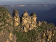
Australia also has some mountainous areas and plateaus scattered throughout the country. The Blue Mountains, on the south-eastern end of Australia, get their name from the blue haze caused by oil droplets given off from the eucalyptus trees. As an island, Australia also has many beautiful coastal beaches.
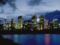
Over 70% of Australians now live in cities or towns. Most of this population lives in the eastern and southern coasts, and around Perth in the west.
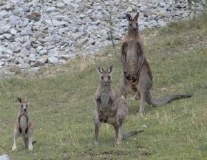
Australia is home to many animals not found anywhere else in the world.
These include the kangaroos and the koala.
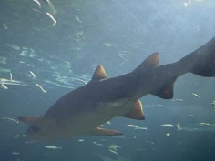
Off the northeast coast of Australia is the Great Barrier Reef. The Great Barrier Reef is over 1,200 miles of coral. It has developed over the last million years, and is now the largest living structure in the world.
It is home to many sharks and thousands of different types of tropical fish.
The Native Australians, or Aborigines, have lived in Australia for at least 40,000 years. In 1788, the British founded a prison colony on the east coast of Australia, in New South Wales. As more Europeans moved to Australia, the Aborigines were driven from their land. Australia is still part of the British commonwealth.
The Native Australians, or Aborigines, have lived in Australia for at least 40,000 years. In 1788, the British founded a prison colony on the east coast of Australia, in New South Wales. As more Europeans moved to Australia, the Aborigines were driven from their land. Australia is still part of the British commonwealth.
Australia is still heavily influenced by its British and European origins. The Australian government is now making major efforts to preserve Australia's culture, including that of the Aboringines.
Much of Australia has a continental climate. The temperatures get hot during the day, then drop considerably at night. Australia is also very arid, getting very little rain.
Welcome to Australia!
Thank you very much. After your project work I’d like to visit these countries.
Let’s sum up the results.
What interesting information have you learned about these countries?
III. Finishing the lesson
Summary of today’s work at the lesson.
Homework p. p. 136-139 “ Into My Portfolio”
Marks.
про публікацію авторської розробки
Додати розробку
